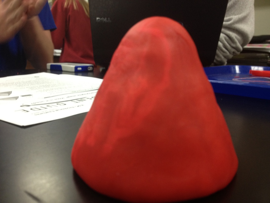
Building Topographic Maps Lab
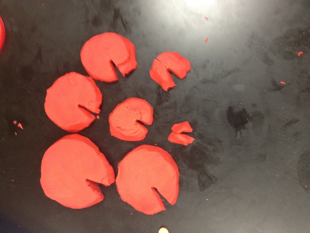
***Part One: Mapping the Mountain
|
|
1) What do the lines of your map represent?
the elevation of the mountain
2) The lines of a topographic map are called contour lines. Use a highlighter and highlight one of the contour lines in your drawing
the elevation of the mountain
2) The lines of a topographic map are called contour lines. Use a highlighter and highlight one of the contour lines in your drawing
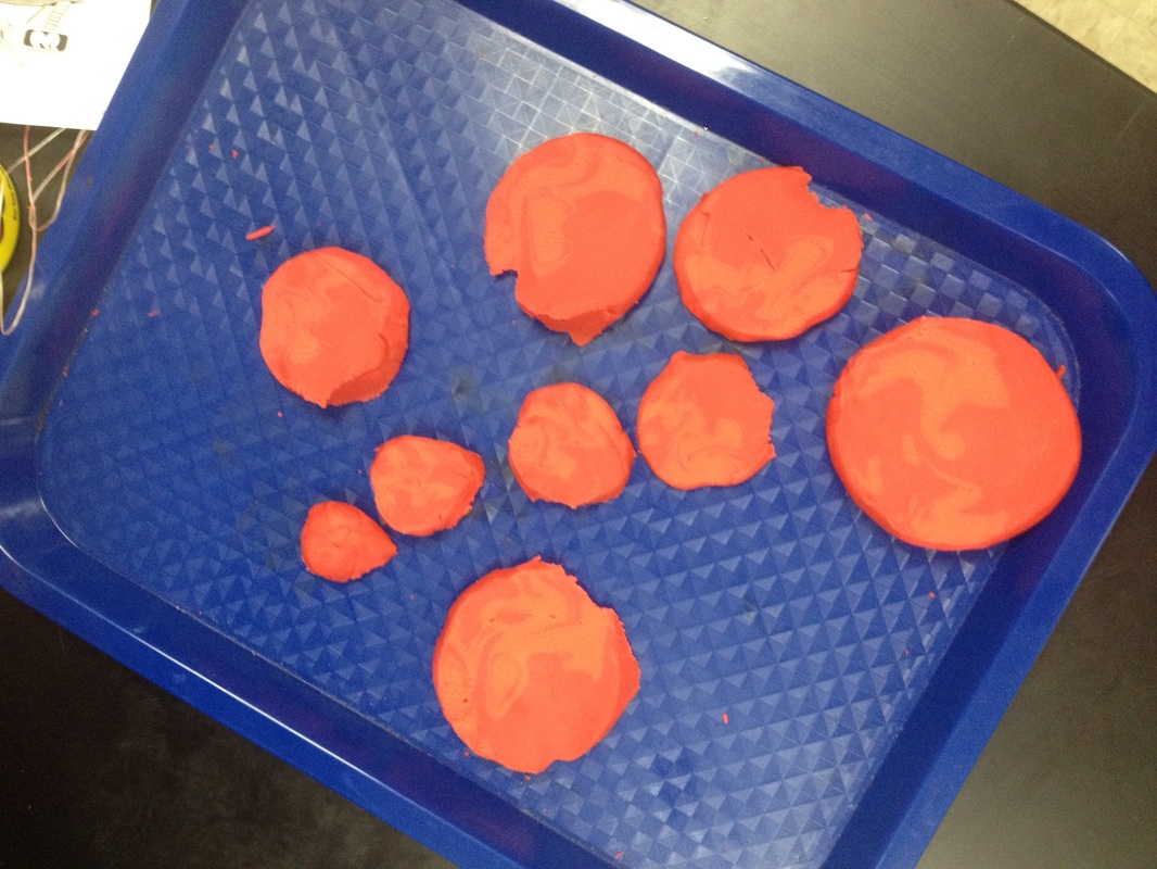
3) What information do the contour lines give the map reader?
the height of the mountain and the steepness of the mountain and the shape
4) Give an example of when someone might use a topographic map.
When a person wants to hike to the top of a mountain, but wants to know what the halfway point is, he needs to know the height of the mountain and divide it by two.
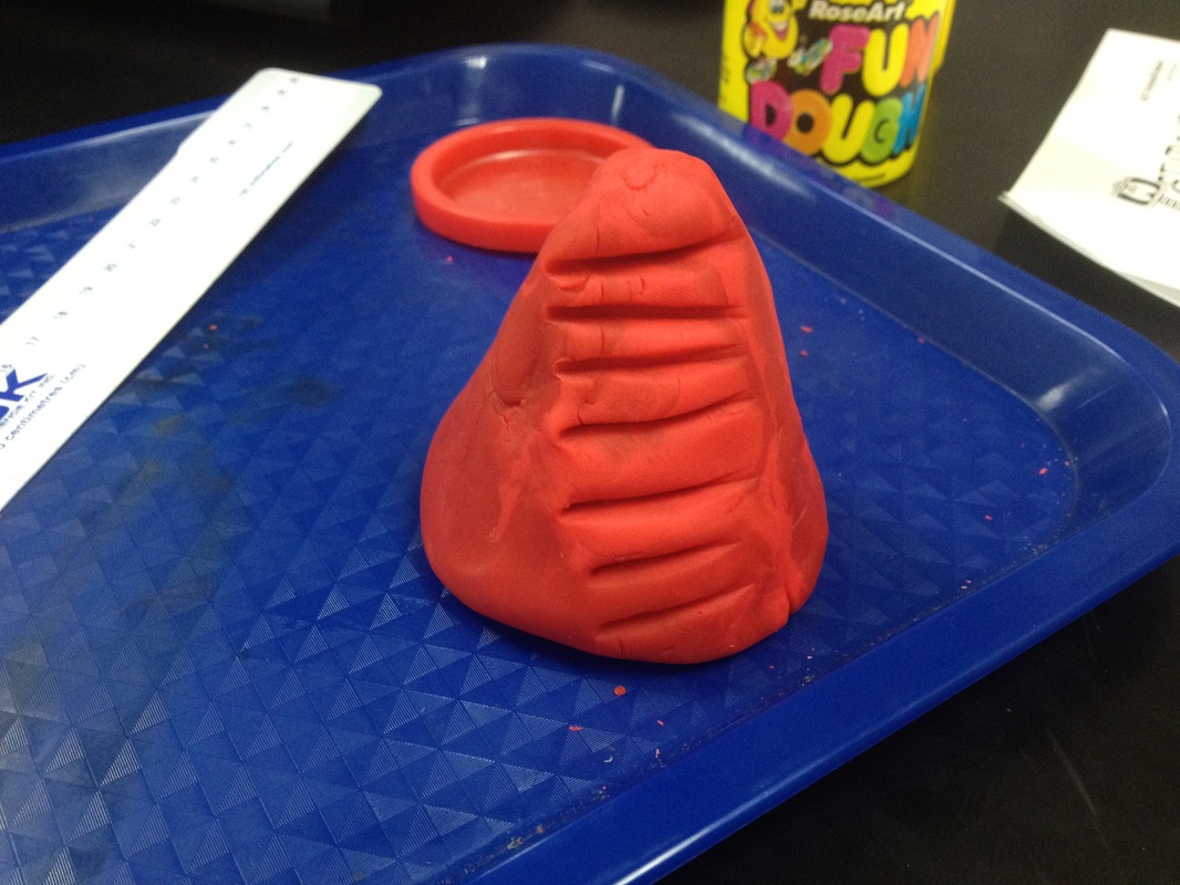
***Part Two: Mapping the Mountain with a Stream
1) Trace the layers of your mountain that has begun to be eroded by a stream.
the height of the mountain and the steepness of the mountain and the shape
4) Give an example of when someone might use a topographic map.
When a person wants to hike to the top of a mountain, but wants to know what the halfway point is, he needs to know the height of the mountain and divide it by two.
***Part Two: Mapping the Mountain with a Stream
1) Trace the layers of your mountain that has begun to be eroded by a stream.
1) How was this map drawing different from the first map drawing?
There was a slice in each layer
2) What effect has the stream had on the mountain?
It eroded the mountain
3) What do you predict will happen as the stream continues to erode the mountain?
The mountain will erode further, and it will make a wider slice.
4) Based on your drawing, what would you look for in the contour lines of a topographic map to identify stream erosion of a landform?
How wide the slice in the mountain is.
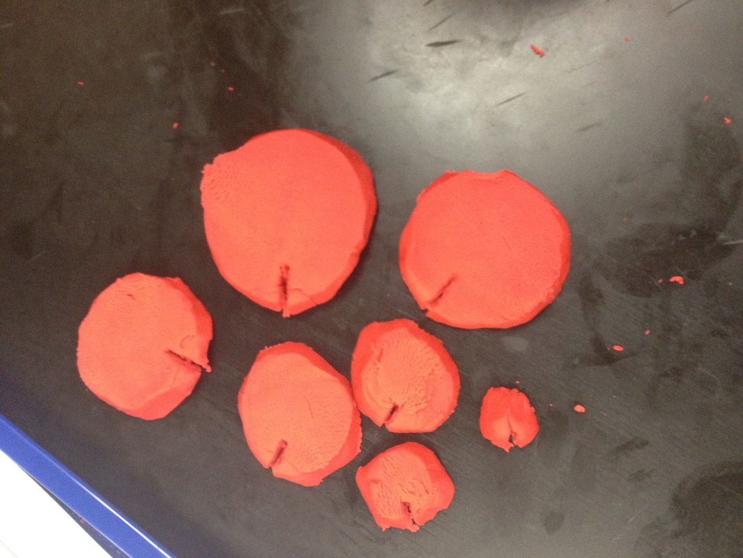
***Part Three: Mapping the Mountain with a River
1) Trace the layers of your mountain that has been further eroded by a stream
There was a slice in each layer
2) What effect has the stream had on the mountain?
It eroded the mountain
3) What do you predict will happen as the stream continues to erode the mountain?
The mountain will erode further, and it will make a wider slice.
4) Based on your drawing, what would you look for in the contour lines of a topographic map to identify stream erosion of a landform?
How wide the slice in the mountain is.
***Part Three: Mapping the Mountain with a River
1) Trace the layers of your mountain that has been further eroded by a stream
1) How has the map drawing changed now?
The slice in the layer is wider than before
2) What do contour lines that are close together indicate?
Steeper territory
3) How has the river effected the mountain?
It has widened the slice, allowing a river to form.
4) Predict what you think will happen if the river continues to erode the mountain.
The slice will become wider and deeper
5) How can a scientist use a topographic map to observe erosional changes in landforms over time?
As the years go by, scientists can compare topographic maps to see if the landforms have changed.
