Weather Map Search
-Visible Satelite
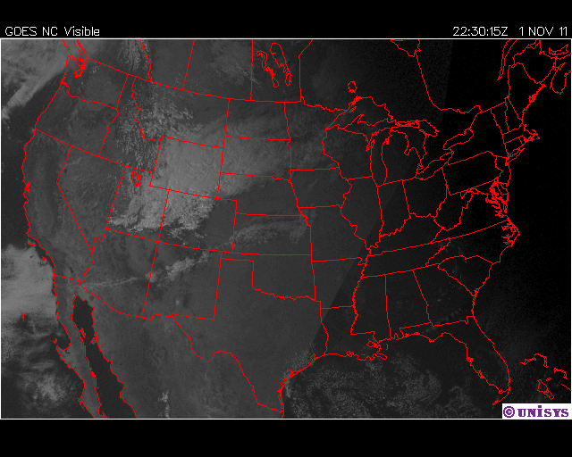
1. What type of weather information is displayed on your map?
Visible Satellite images. Precipitation and cloud formation.
2. Do you see any ares experiencing storms? How can you tell?
Not necessarily storms, maybe some precipitation, there are some clouds in the northwest areas of the United States.
3. How can this information help you to predict the weather?
This information can help predict where the cloud masses are and when they may be coming your way.
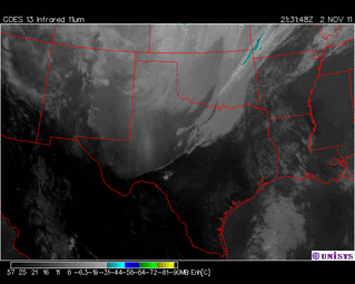
-Enh IR Satelite
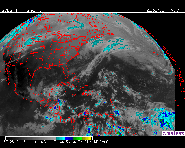
1. What type of weather information is displayed on your map?
The highest clouds in the nation cover the northwest states, and low cloud masses cover some states surrounding that.
2. Do you see any ares experiencing storms? How can you tell?
The area experiencing some weather is mainly in Wyoming, although it does go into part of Montana, and North and South Dakota. You can tell by looking at the color of the mass. Because it is cyan, and light blue, this means that there are jet stream clouds, and among them, anvil clouds.
3. How can this information help you to predict the weather?
This information helps predict the weather, because if at some point, the clouds gain more precipitation, then they may become thunderstorm clouds, and that way, you can know when a thunderstorm is coming your way.
-Surface Map
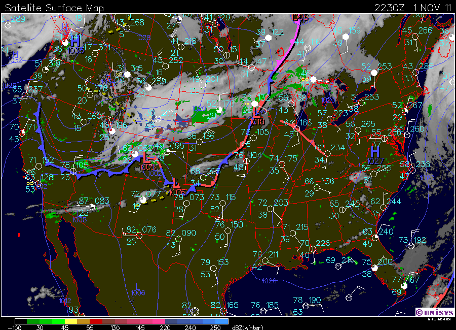
1. What type of weather information is displayed on your map?
There is a cold front going along the west coast to the state of Colorado, with a low pressure of 1005, then going to a stationary front into Texas and northeast in the nation. there is some precipitation in the northwest region, and winds mostly come from the south and the southeast. Some winds may also be from the west. There is high pressure in the area of the state of Virginia, with 1027 millibars. Most cloud coverage is clear, and wind speed is not as fast.
2. Do you see any ares experiencing storms? How can you tell?
Storms are mainly traveling in the northern part of the country, with some precipitation. There is also little precipitation throughout the nation, almost in every state.
3. How can this information help you to predict the weather?
This information can help predict weather because it says which way the winds are going, and what kind of fronts are coming in, so they would help people know what kind of weather to expect.
|
|
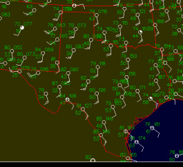
-Local
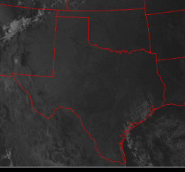
1. What type of weather information is displayed on your map?
Temperatures in Texas are among the 70's and the 80's, cloud coverage is clear, and winds range from 8-17 knots. also, there may be some clouds coming in in the future days, as the clouds travel from the northeast regions towards Texas.
2. Do you see any ares experiencing storms? How can you tell?
There is currently no areas experiencing storms because there are no precipitation-loaded clouds in Texas
3. How can this information help you to predict the weather?
This information helps to predict the weather because it tells you the temperature of your local area, and how the future days are looking-precipitation wise.
